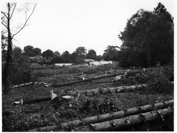
RHW08402 View of tree felling at the bottom of Marlow Hill, High Wycombe. Oct 1926 Landscape, Woodland Abbey Grounds Sweetland, View of tree felling, probably at the bottom of Marlow Hill, for building the hospital? 1926 08402
Photographer: Sweetland,
-
BFP33394
BFP33394 Looking Southeast, a view of the old Morning Star PH and surrounding premises at the junction of Pennington Row/Totteridge Rd, High Wycombe. late 1931 Streetscape Totteridge Road Sweetland, Totteridge Road at the junction with Pennington Row. A Wheelers Wycombe Brewery public house (The Morning Star) stands on the corner and the houses in Pennington Row drop down to the railway. 1931 33394 Stone, Robert George, (Publican)
-
RHW39069
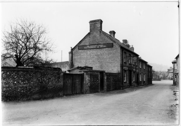
RHW39069 A view of the Disraeli Arms PH, as seen looking West along Ford Street, Wycombe Marsh. about March 1931 Streetscape Ford Street Sweetland, The Disraeli Arms in Ford Street, Wycombe Marsh. Ales supplied by Wethereds of Marlow 1931 39069 Easton, George, (Publican)
-

RHW46062
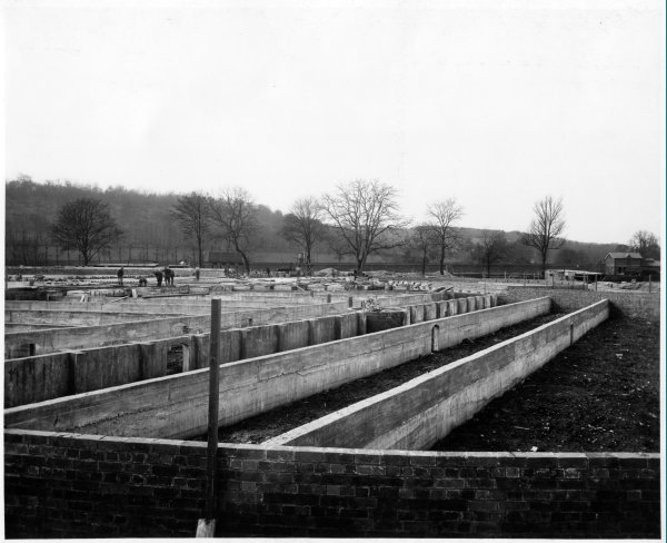
RHW46062 Looking East, a view of construction of sewage beds at the sewage works, Wycombe Marsh. March 1923 Construction Back Lane Sweetland, Construction of sewage beds at sewage works, Wycombe Marsh. Chimney of mill in back lane at centre right, that of Marsh Mill left behind trees (HDC) [a]for scanning 1923 46062
-
RHW46063
RHW46063 Looking SW(?), a view of construction of sewage beds at the sewage works, Wycombe Marsh. March 1923 Construction Back Lane Sweetland, Construction of sewage beds at the sewage works, Wycombe Marsh. [a]for scanning 1923 46063
-
RHW24627
RHW24627 View of houses and floodwaters at Pictonville, as seen looking W along the Bradenham Rd, nr West Wycombe. Feb 1928 Streetscape Bradenham Sweetland, Pictonville. Houses on the Bradenham Road and the floodwaters Scan [a] 1928 24627
-

MHW01411
MHW01411 View from NW of Glenister’s chair factory facing onto Bellfield Rd with Parker Knoll factory to the right, Bellfield Rd, High Wycombe. June 1929 Commercial building, Landscape MHW Bellfield Road Sweetland, View of Glenister’s chair factory facing onto Bellfield Rd with Parker Knoll factory to the right, houses to E. of Hughenden Rd and parish church in background. 1929 01411 Glenister, Thomas, (Chair-maker), Parker Knoll, (Furniture Makers)
-

RHW08366
RHW08366 Looking NE from Tom Burt’s Hill, the War Memorial Hospital in the foreground of a View across the western end of High Wycombe. mid 1925 Hospital, Landscape Tom Burt’s Hill Sweetland, The War Memorial Hospital in the foreground of a panoramic view from Tom Burt’s hill Venn copy of a Sweetland original 1925 08366
-

RHW08368
RHW08368 Looking NE from Tom Burt’s Hill, the football ground in the foreground of a panoramic view of High Wycombe. Oct 1930 Landscape High Wycombe (central) Sweetland, General view of High Wycombe looking across Loakes Park,Wycombe Wanderers Football ground to All Saints church and the town 1930 08368
-

RHW08369
RHW08369 Looking NE from Tom Burt’s Hill, the football ground in the foreground of a panoramic view of High Wycombe. Oct 1930 Landscape High Wycombe (central) Sweetland, View of High Wycombe looking across Loakes Park,Wycombe Wanderers football ground to the church and up to terriers and Totteridge 1930 08369
-
RHW08361
RHW08361 Looking NW from Keep Hill, a panoramic view of the western end of High Wycombe. c June 1930 Landscape, Woodland High Wycombe (outer) Sweetland, View of the western end of High Wycombe from Keep hill 1930 08361
-
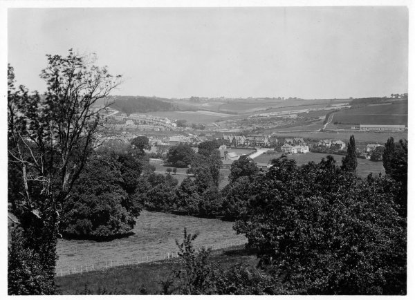
RHW08365
RHW08365 Looking Northwest from Keep Hill, a general view of the town centre and western end of High Wycombe. c June 1930 Landscape High Wycombe (outer) Sweetland, General view of western end of High Wycombe from Keep Hill across the Rye to Pann Mill and beyond 1930 08365
-
RHW24606
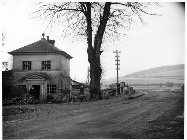
RHW24606 View of The Lodge and building work in progress outside the entrance to West Wycombe Park as seen looking W from the High Street, West Wycombe. Nov 1926 Streetscape High Street, West Wycombe Estate Sweetland, The High St. Work in progress outside the Lodge,West Wycombe Park Scan [b] 1926 24606
-
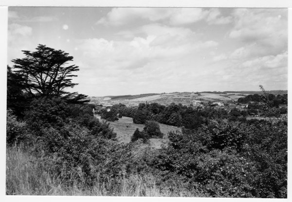
RHW08360
RHW08360 Looking NW from Keep Hill, a general view across the Abbey grounds to the western end of High Wycombe. c June 1930 Landscape, Woodland Wycombe Abbey Area Sweetland, General view across Abbey grounds, of the western end of High Wycombe Venn copy of a Sweetland original 1930 08360
-
RHW08338
RHW08338 Looking N from Keep Hill, a general view of Bassetsbury area and the Bowerdean valley. High Wycombe. June 1921 Landscape Bassetsbury Area Sweetland, View of Bassetsbury area with Totteridge Avenue and the Bowerdean farm area in the background Scan [a] 1921 08338
-

RHW24594
RHW24594 View looking SE towards the houses at Pictonville, along the Bradenham Rd, Nr West Wycombe. Feb 1927 Landscape Bradenham Sweetland, W of Pictonville Nr West Wycombe. The Bradenham Road looking SE Scan [b] 1927 24594
-
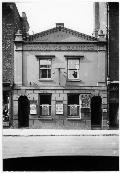
RHW01358
RHW01358 View from N. of South Bucks Savings Bank in Church St, High Wycombe. about June 1925 Commercial building RHW Church Street Sweetland, View of South Bucks Savings Bank, classical styled building with inscriptions 1818 and Erected MDCCCXLI, posters for Harold J.Nutt auctioneer and estate agent 1925 01358
-

RHW01359
RHW01359 Crowds watching band marching E. along High St as part of band contest, passing junction with Corporation St, High Wycombe. about Jun 1930 Streetscape RHW High Street area Sweetland, Crowds watching band marching E. along High St as part of band contest, motor vehicles, market stall, showing on N. side Barclays Bank, Davenport Vernon garage, Wycombe Bank, Red Lion Hotel, Parish Church in background 1930 01359
-
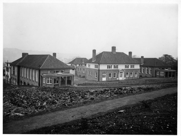
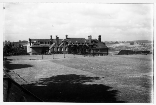
RHW01340
RHW01340 Seen from the Southwest, a view of Wycombe Memorial Hospital, Marlow Hill, High Wycombe. Sept. 1923 Exterior, Hospital RHW Marlow Hill Sweetland, View of S facing buildings of Wycombe Memorial Hospital a year after laying of foundation stone. Scan [a] 1923 01340
-
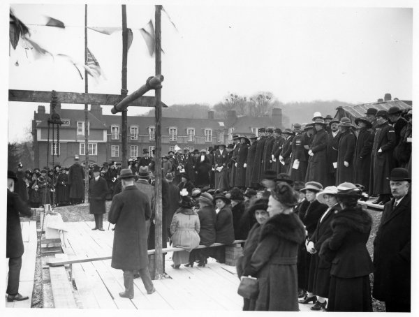
RHW01341
RHW01341 Laying of foundation stone of the War Memorial Hospital, on W. side of Marlow Hill,High Wycombe. March 1922 Exterior, Group RHW Marlow Hill Sweetland, Laying of foundation stone of the War Memorial Hospital, on W. side of Marlow Hill, with dignitaries and nurses with medals, boarding house of Wycombe Abbey School in background Scan [a] 1922 01341
-

RHW01342
RHW01342 From NW, a view of N and W facing sides of War Memorial Hospital, Marlow Hill, High Wycombe. Sept. 1923 Hospital RHW Marlow Hill Sweetland, View of N and W facing sides of War Memorial Hospital 1923, the year it was opened 1923 01342
-

RHW01343
RHW01343 From SW, a view of S and W facing sides of War Memorial Hospital, Marlow Hill, High Wycombe. May 1925 Hospital, Landscape RHW Marlow Hill Sweetland, View of S and W facing sides of War Memorial Hospital Marlow Hill, two years after it opened. Scan [a] 1925 01343
-
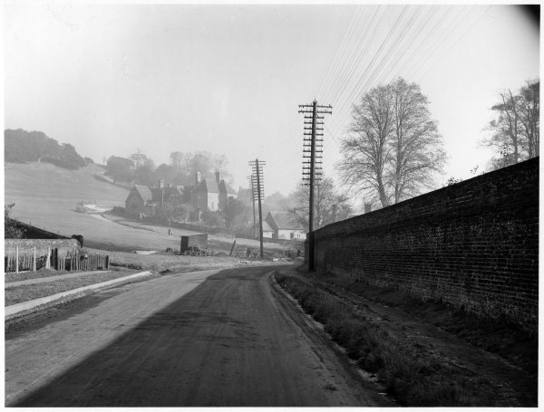
RHW24578
RHW24578 View looking NW along the Bradenham Rd from West Wycombe. c 1920 Landscape Bradenham Sweetland, Bradenham Rd nr West Wycombe. view of the road leading to Bradenham from West Wycombe (not Saunderton Rd) 1920 24578
-
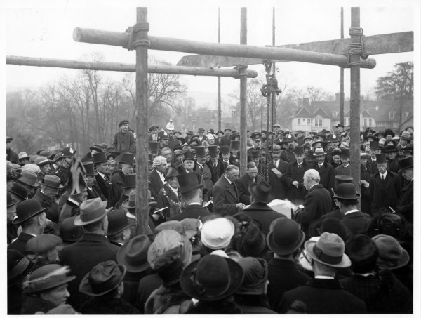
RHW01333
RHW01333 Laying foundation stone for War Memorial Hospital on Marlow Hill, High Wycombe. March 1922 Official photo RHW Marlow Hill Sweetland, Laying foundation stone for War Memorial Hospital on Marlow Hill, replaced Cottage Hospital, built as memorial to men killed in W.W.1, site given by Marquis of Lincolnshire, later demolished late 1960s Scan [a] 1922 01333
-
RHW24585
RHW24585 View of the Chancel of the Church of St.Lawrence, West Wycombe Hill, West Wycombe. may 1920 Church West Wycombe Church Sweetland, The Church of St Lawrence. The Chancel Scan [a] 1920 24585
-

RHW24569
RHW24569 View of the Church Loft assembly rooms as seen on the N side of the High St, West Wycombe. late 1928 Streetscape High Street Sweetland, West Wycombe High St. View of the Church Loft assembly rooms 1928 24569
-

RHW12416
RHW12416 looking North, the front of the Union Baptist Church, rebuilt after the fire which destroyed it in 1908. Easton St, High Wycombe. c 1926 Church, Exterior Easton Street Sweetland, Union Baptist Church. Easton St, High Wycombe after rebuilding 1926 12416
-
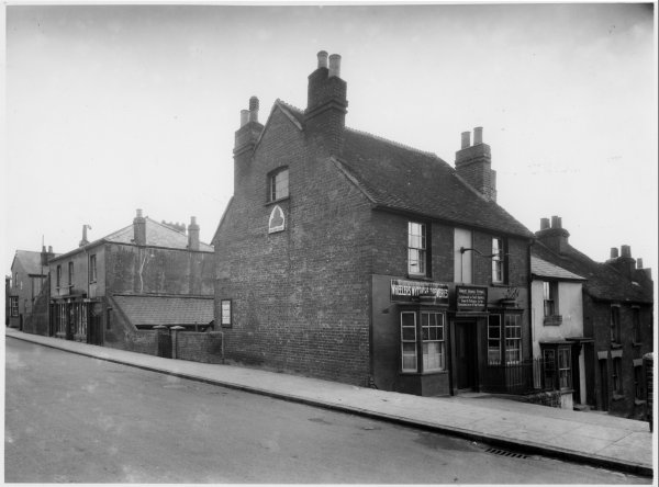
RHW39044
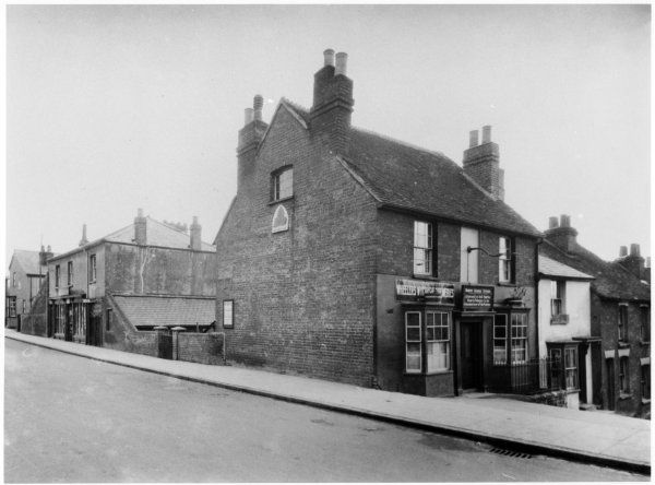
RHW39044 Looking SE, a view of The Morning Star public house and adjacent premises in Totteridge Road, High Wycombe. late 1931 Commercial building, Streetscape Totteridge Road Sweetland, The Morning Star, Totteridge Road. Over the door of the pub is Wheelers Wycombe Breweries sign, also the name of the licensee of the pub, Robert George Stone. On the side of the pub is a sign with the wording The Hop Leaf, and an advert for the Majestic cinema. The shop to the left has some signs on the side and front; there is also some kind of mast to the far left of the picture. Scan [a]. [b] is a heavily cropped Venn copy, dimensions 156x107mm 1931 39044 Stone, Robert George, (Publican), Pitman, (Grocer)
-

RHW01294
RHW01294 Seen from the NE, a view of some of the buildings of Wycombe High School, Benjamin Road, High Wycombe. Sept 1923 Exterior, School RHW Benjamin Road Sweetland, View of block of buildings with small cupola in Wycombe High School, later Known as Lady Verney High School. 1923 01294
-

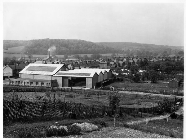
RHW43049
RHW43049 Looking NW across West End Recreation Area towards a line of furniture factories in West End Road, High Wycombe. Oct 1920 Landscape West End Road Sweetland, West End Rec showing marked-out areas (bowls?, football?) and in middle distance several furniture factories (inc Goodearls) Scan [a]. marks in sky area on [b] 1920 43049
-
RHW01278
RHW01278 From NE, a view of the grounds and rear of Godstowe School, Amersham Rd, High Wycombe. July 1925 Exterior, School RHW Amersham Road Sweetland, Back view of Godstowe School buildings and school field Scan [c].[a] and [b] are slightly cropped photo prints, dimensions 152x110mm 1925 01278
-

RHW24510
RHW24510 View of West Wycombe Hill, Church and Mausoleum as seen looking W from the Pedestal, West Wycombe. April 1927 Landscape, Monument West Wycombe Sweetland, The Pedestal View of West Wycombe Church and Mausoleum Many grubby marks in the sky-area 1927 24510
-
RHW24489
RHW24489 View from the A40, Oxford Road, of the village school and school house at the foot of West Wycombe Hill, West Wycombe. Nov 1926 Streetscape West Wycombe Sweetland, Stokenchurch Rd.West Wycombe. View of village school and school house on West Wycombe hill. Wall of West Wycombe Park to left actual originator not marked on photograph but from the number sequence it appears to be Sweetland. 1926 24489
-
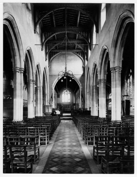
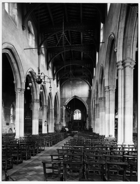
RHW08216
RHW08216 Looking East along the aisle, from opposite the South door an interior view of All Saints Parish Church, High Wycombe. mid 1929 Church, Interior High Wycombe (central) Sweetland, Interior view of All Saints parish Church looking towards the altar 1929 08216
-
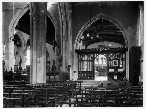
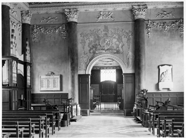
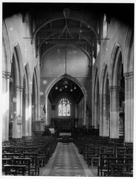
RHW08217
RHW08217 Chapel of the Gild of St Mary features in an interior view of All saints Parish Church, High Wycombe. Aug 1923 Church, Interior High Wycombe (central) Sweetland, View of the main body of the church and the chapel of Gild of St Mary in particular 1923 08217
-
RHW23039
RHW23039 Looking SW, a view of Thames Valley Bus Garage in London Road, Wycombe Marsh. May 1929 Landscape Micklefield Sweetland, Thames Valley Garage in London Road near Micklefield viewed from NE Scan [a] 1929 23039
-
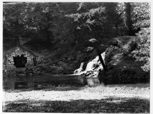
RHW08181
RHW08181 View of Waterfall and Grotto at the eastern end of the Dyke, Wendover Way, the Rye, High Wycombe. Aug 1923 Landscape Wendover Way Sweetland, View of the waterfall and Grotto at eastern end of the Dyke, Wendover Way, with a man standing by the grotto 1923 08181
-

RHW08175
RHW08175 View of the Grotto and water fall, at the eastern end of the Dyke, Wendover Way, the Rye, High Wycombe. Aug 1923 Landscape Wendover Way Sweetland, View of the Grotto and waterfall, water features built at the eastern end of the Dyke Scan [a]. [b] is a sepia postcard, size 130mm x 81mm 1923 08175
-

RHW08176
RHW08176 Children posed on the steps, and above the waterfall built at the eastern end of the Dyke, Wendover Way, the Rye, High Wycombe. late 1920 Landscape Wendover Way Sweetland, View of the waterfall, built at the eastern end of the Dyke 1920 08176
-
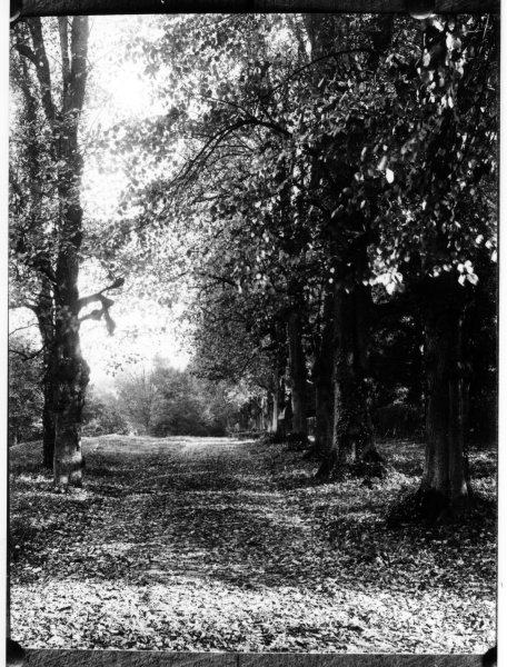
RHW08179
RHW08179 View of mature trees, possibly viewed from the West. Wendover Way, The Rye, High Wycombe. late 1924 Landscape Wendover Way Sweetland, Written on back, Wendover Way, 1924 08179
-
RHW12311
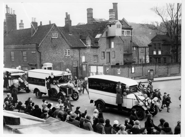
RHW12311 Procession of McIlroy’s vans going along Easton St. past Wheelers brewery on the corner of Queen Victoria Rd. High Wycombe. late 1932 Commercial building Easton Street, Queen Victoria Road Sweetland, Easton St. High Wycombe. McIlroy vans, decorated with Balloons and ribbons, passing the brewery (For Sale) in Easton St. 1932 12311 McIlroy, William, (Clothier)
-
RHW08164
RHW08164 View looking NE from near to the West door, along the nave of All Saints Parish Church, High Wycombe. about 1921 Church, Interior Church Square Sweetland, Interior of All Saints Parish Church, from near South door towards the altar 1921 08164
-
RHW08165
RHW08165 View looking E along the aisle of All Saints Parish Church, High Wycombe. Aug 1923? Church, Interior High Wycombe (central) Sweetland, Interior of All Saints Parish Church, looking from slightly nearer to the altar than RHW08164 1923 08165
-

RHW08148
RHW08148 Close up of the Monument to Earl Shelburne (Petty Memorial), in All Saints Parish Church, High Wycombe. late 1927 Church, Interior High Wycombe (central) Sweetland, Memorial to William Petty, Earl of Shelburne, All Saints Church, High Wycombe, by Scheemakers, 26ft high an altar pedestal, bearing a sarcophagus of grey marble, on which a reclining figure of the earl lies. 1927 08148
-
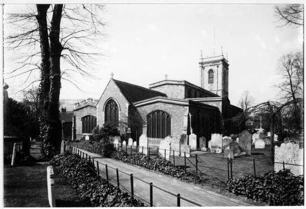
RHW15078
RHW15078 A view of the North East fronts of All Saints Parish Church, High Wycombe. about April 1929 Church Castle Street Sweetland, A north east view of the All Saints Parish Church Scan [a] 1929 15078
-

RHW12271
RHW12271 A Bodger’s Hut, with the Bodger roughing out a chair leg prior to turning. Location unknown. May 1929? Exterior, Industrial Bucks Sweetland, A Bodger at work. This man also appears in RHW12270. [b] To be digitised. [a] is cropped at LHS [a] dimensions are 265mm x 201mm 1929 12271
-
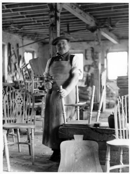
RHW12272
RHW12272 A chair-maker at work, fitting a chair-back onto a chair. Location unknown. Circa 1930 Industrial, Interior Bucks Sweetland, A Bodger at work, framing up the back of a Windsor chair [a] To be digitised [b] Dimensions are 102mm x 148mm. cropped version of [a] 1930 12272
-
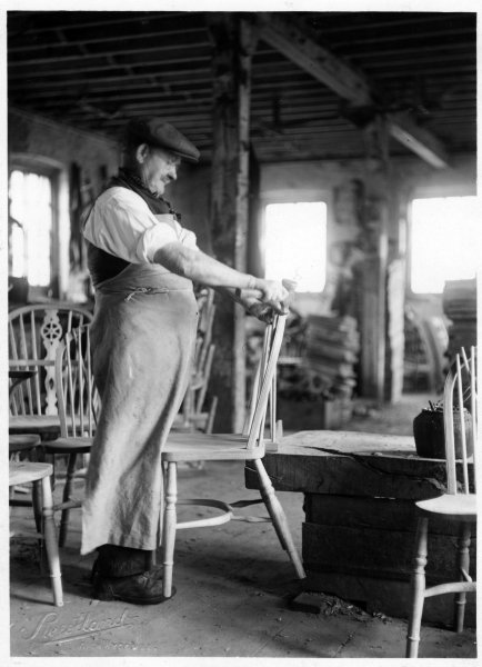
RHW12278
RHW12278 A Chair Framer completing the seat section of a chair, with a nearly completed Wheel-back chair on the left. Location unknown. Feb 1922 Industrial, Interior Bucks Sweetland, Chair Framer at work in factory workshop 1922 12278
-
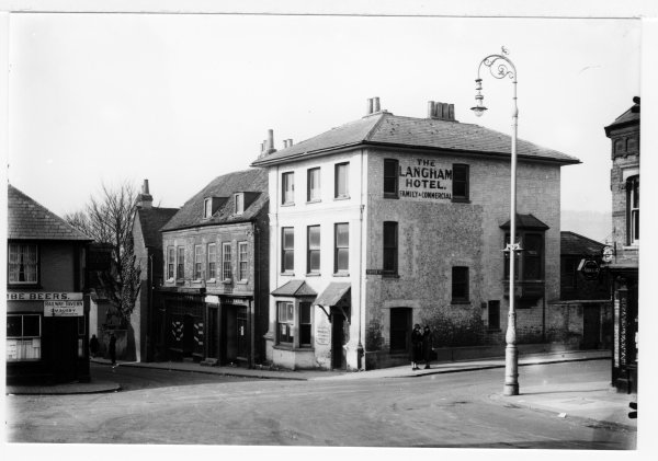
RHW37008
RHW37008 Hotels on the junction of Crendon Lane and Castle Street seen from the bottom of Amersham Hill, High Wycombe. March 1930 Streetscape Amersham Hill, Castle Street, Crendon Street Sweetland, Langham Hotel, corner of Railway Tavern and Railway Temperance Hotel and entrance to Railway Tavern Yard. 1930 37008 Busby, C.M., Hards
-
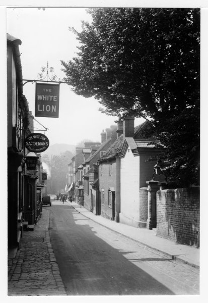
RHW37009
RHW37009 View from outside Railway Tavern, looking S towards High Street along Crendon Lane, High Wycombe. April 1928 Streetscape Crendon Street Sweetland, View of Crendon Lane to High Street junction, White Lion on left, gates to United Chapel on right 1928 37009