
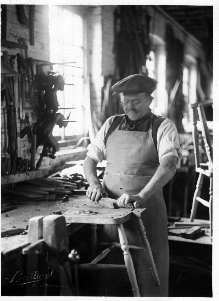
RHW12250 Chair-maker doing fretwork on a chair-back. Location unknown. c1920 Industrial, Interior UK Sweetland, Chair-maker at work on a wheel-back splat Sweetland is embossed in the bottom left corner. 1922 12250
Photographer: Sweetland,
-
RHW12251
RHW12251 Chair-maker shaping the chair seat of a partially completed Windsor chair. location unknown. c1920 Industrial, Interior UK Sweetland, Chair-maker at work shaping a chair seat of a partially completed Windsor chair Same man as appears in RHW12250 Sweetland is embossed in the bottom left corner. 1922 12251
-

RHW12253
RHW12253 A man (Owen Towerton?) working at his Pole Lathe making chair legs for the local furniture industry. possibly Stokenchurch. c 1930 Industrial, Interior UK Sweetland, probably Stokenchurch? A man (Owen Towerton?) working at his Pole Lathe inside a building. Turning chair legs/stretchers 1930 12253
-
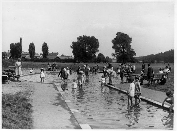
RHW08109
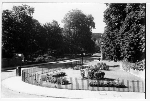
RHW08109 Children enjoying the sun and water at the eastern end of the paddling pool on Rye Mead, London Road, High Wycombe. July 1930 Landscape The Rye Sweetland, View of the eastern end of paddling pool on the Rye, being enjoyed by many children in the sun Scan [a] 1930 08109
-

RHW08107
RHW08107 Before the playground equipment was installed, children enjoying the paddling pool on the Rye, London Road, High Wycombe. July 1930 Landscape The Rye Sweetland, Paddling pool on Rye Mead, looking east towards Rye Mill, with houses on London Road on left, and LOTS of children. This is before the playground equipment was installed 1930 08107
-
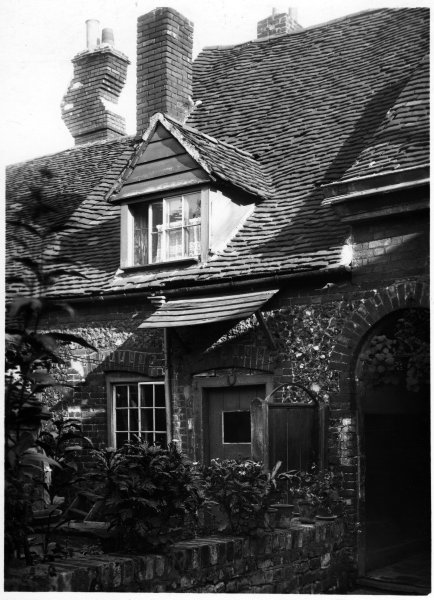
RHW47002
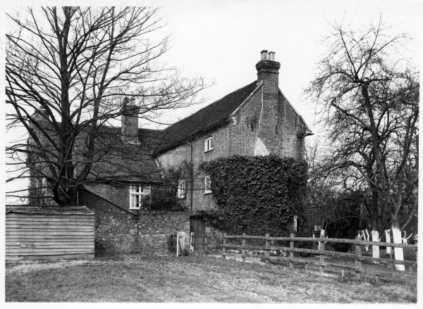
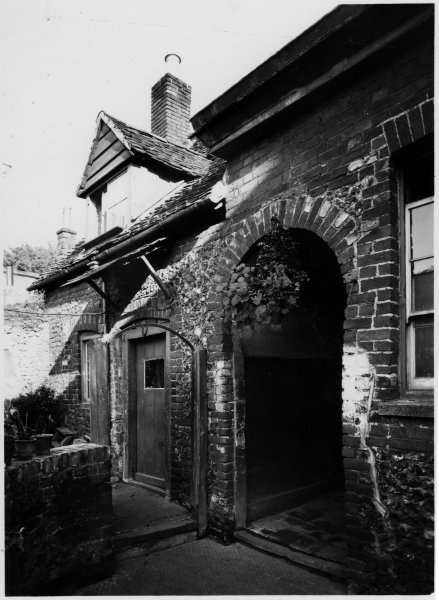
RHW47002 Looking from west, towards east, the rear of the house next to the Meeting House in Crendon Street High Wycombe. October, 1922 Domestic building Crendon Street Sweetland, House next to the Meeting House. Interesting chimney of the house Scan [a] Size of [c] 158 by 245 mm 1922 47002
-
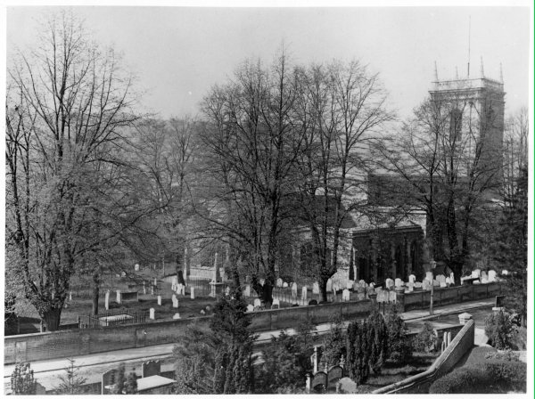
RHW15073
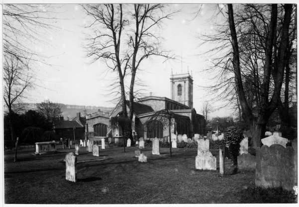
RHW15073 The portion of the graveyard to the N of Castle St still intact in a View from NE of All Saints Parish Church, High Wycombe, c1920. Church, Landscape Castle Street Sweetland, View of the Parish Church from NE, including the portion of the grave yard to North of Castle St, with stones still standing 1920 15073
-
RHW15076
RHW15076 A view through the churchyard, of the eastern end of All Saints Parish Church, High Wycombe. about April 1929 Church, Exterior Castle Street Sweetland, View from East of All Saints Parish Church and graveyard white Specks in sky 1929 15076
-
RHW29088
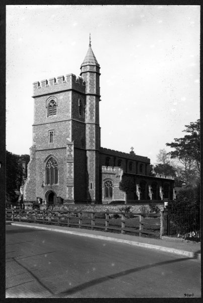
RHW29088 View, from the main road looking NE, of St Paul’s Church, Wooburn Town. c April 1929 Church, Streetscape Wooburn Town Sweetland, St Paul’s Church, Wooburn Town, viewed from the main road. 1929 29088
-
RHW08077
RHW08077 View of Bassetsbury Manor, Bassetsbury Lane, High Wycombe, inner courtyard about 1925 Domestic building, Exterior Bassetsbury Area Sweetland, View of Bassetsbury manor before extensive building work was done by Mr Skull, inner courtyard 1925 08077
-

RHW08078
RHW08078 view of Bassetsbury Manor, Bassetsbury Lane, High Wycombe before restoration about 1925 Domestic building, Exterior Bassetsbury Area Sweetland, View of Bassetsbury Manor but hard to say which side–or where viewed from–is it the river in foreground? 1925 08078
-

RHW40003
RHW40003 The Bull Public House on the corner of Bull Lane/White Hart Street, High Wycombe. early 1931 Streetscape Bull Lane, White Hart Street Sweetland, Public house on the corner of Bull Lane 1931 40003 Wheeler, (Brewer)
-

RHW08065
RHW08065 Fruit trees, and the door in the north front of Bassetsbury Manor, Bassetsbury Lane, High Wycombe. early 1925 Domestic building, Exterior Bassetsbury Area Sweetland, Bassetsbury Manor, Bassetsbury Lane, view of north front with a door, and fruit trees in foreground Scan [a] 1925 08065
-
RHW12173
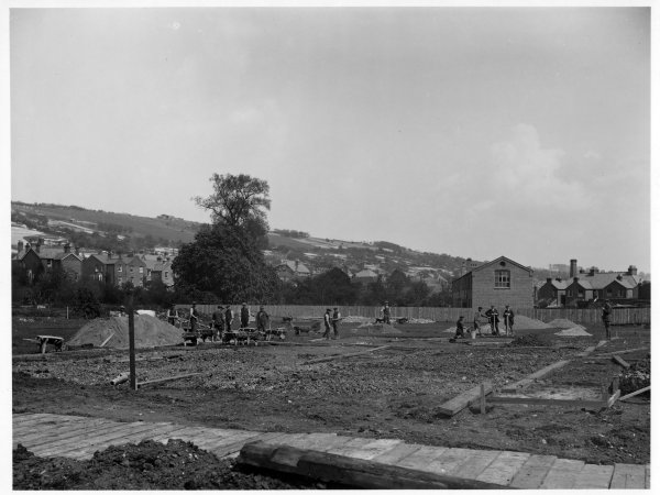
RHW12173 View from the west, looking east, of a building site in Abercrombie Ave, High Wycombe. May 1920 Commercial building, Domestic building, Landscape Abercrombie Avenue Sweetland, Building site in Abercrombie Ave. 1920 12173
-

RHW38001
RHW38001 View looking south towards Church Street along Priory Road, High Wycombe. July 1928 Streetscape Priory Road Sweetland, 1928 38001
-
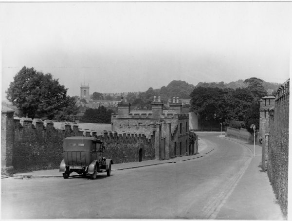
RHW39001
RHW39001 Abbey wall and buildings overlooking the town with the Parish Church in the background. Marlow Hill, High Wycombe. June 1928 Streetscape Marlow Hill Sweetland, car in the foreground, reg ML 9362 1928 39001
-
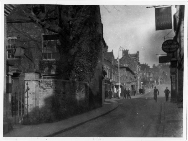
RHW37001
RHW37001 Chapel and public houses at the top of Crendon Street, High Wycombe in 1930. Streetscape Crendon Street Sweetland, Photographed from east pavement below White Lion looking north to Amersham Hill and across to the west side of Crendon Street Low contrast, poor focus, dust marks on print. 1930 37001
-
RHW34001
RHW34001 View towards Frogmoor of shopping scene with Boots on the left, Queen Square, High Wycombe. mid 1920 Commercial building, Streetscape Queen Square Sweetland, Shopping area, Boots chemist noted in foreground. Some white circular blotches noted in lighter areas of the photograph. 1920 34001
-

RHW12163
RHW12163 steps (due to the steepness of the pavement) at Chapel Lane Turning at the junction with West Wycombe Rd, West Wycombe. April 1927 Streetscape Chapel Lane Sweetland, Chapel Lane Turning with junction of West Wycombe Rd. Both photos are the same dimensions. Either can be digitised. 1927 12163
-
RHW23028
RHW23028 View, looking south towards Church Street, of both sides of Priory Road, High Wycombe. July 1928 Streetscape Priory Road Sweetland, [b] is a contact print 1928 23028
-
RHW14079
RHW14079 The new council offices showing front and south sides of the building in Queen Victoria Rd, High Wycombe. c1931/32 Civic building, Exterior, Streetscape Queen Victoria Road Sweetland, 1932 14079
-
RHW23020
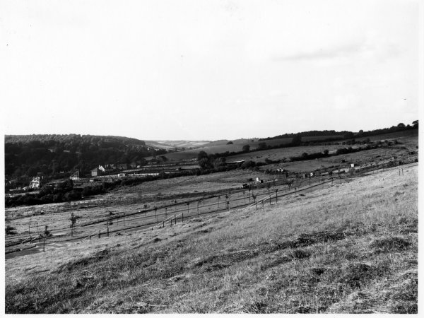
RHW23020 View N along the Cemetery path, part of Hamilton Rd in middle distance and Hughenden Road beyond. Cemetery, Hampden Rd, High Wycombe. July 1927 Landscape Hampden Road Sweetland, Hamilton Rd is in middle distance on LH side with Hughenden Rd behind it 1927 23020
-
RHW08046
RHW08046 Prior to extension/renovation, a view from the Southwest of Bassetsbury Manor, Bassetsbury Lane, High Wycombe. April 1925 Domestic building, Exterior Bassetsbury Area Sweetland, Bassetsbury Manor from the Rye from the southwest, scan [b] 1925 08046
-
RHW23015
RHW23015 Bellfield, Frogmoor Viaduct, the railway and town in the distance in a view looking SW from Cemetery, Hampden Road, High Wycombe. Aug 1927 Landscape Hampden Road Sweetland, High Wycombe can be seen in the distance from the W end including Frogmoor 1927 23015
-
RHW23016
RHW23016 Hughenden Road and trees/fields in the background of a view looking NW of part of Cemetery, Hampden Road, High Wycombe. Aug 1927 Landscape Hampden Road Sweetland, Looking away from High Wycombe with Hughenden Road on L of photograph 1927 23016
-
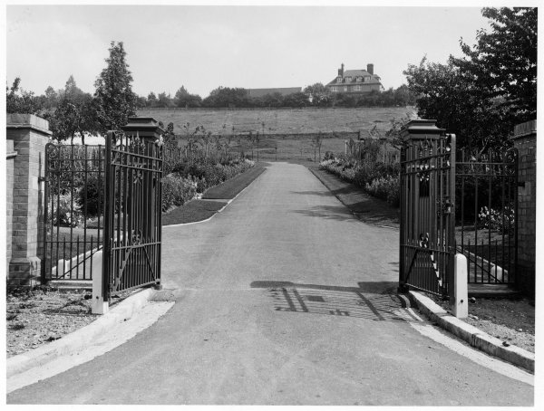
RHW23018
RHW23018 Trees, garden and a house in the background of a view of open gates at entrance to Cemetery, Hampden Rd, High Wycombe. Aug 1927 Landscape Hampden Road Sweetland, Entrance with road leading up to cemetery 1927 23018
-
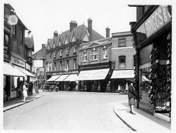
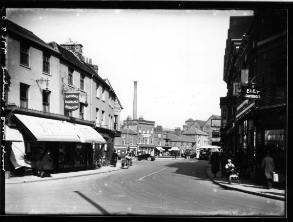
RHW29064
RHW29064 View of shoppers, motor vehicles and bicycle. Queens Square, High Wycombe. about July 1931 Commercial building, Streetscape Queen Square Sweetland, View of Queens Square, with shoppers bicycle, motor-bike and motor car. Several shops have their awnings down. 1931 29064 Briggs, Peace Jones and Co, Woolworth, Luttman, George, F.W., Boot
-
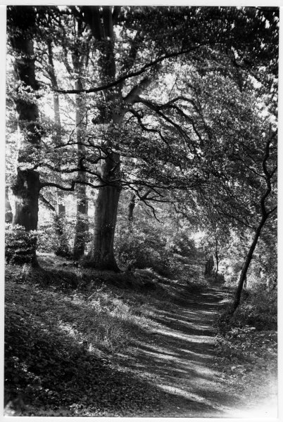
RHW12119
RHW12119 Picturesque view of a track through the beech trees at Keep Hill. High Wycombe. about Sep 1928? Landscape Keep Hill Sweetland, Keep Hill, High Wycombe. As inscribed on the back of the photograph. 1928 12119
-
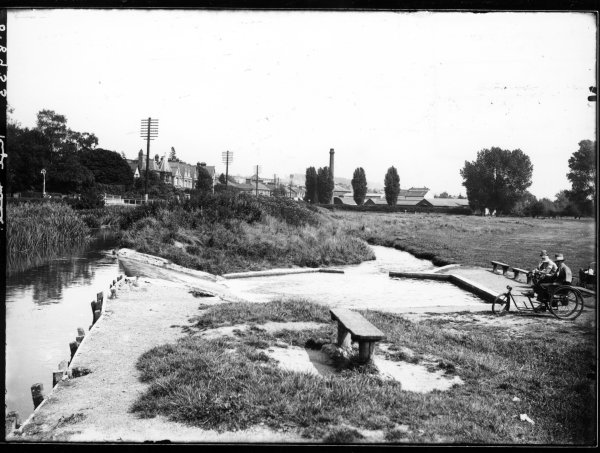
RHW12109
RHW12109 Men with a tricycle, near the early paddling pool on the Rye, London Rd, High Wycombe. July 1928 Landscape London Road, The Rye Sweetland, Men with tricycle near the early paddling pool on the Rye, looking east As inscribed on rear of photo [a] Digitise photo [a] Dimensions of photo [b] 160mm x 113mm [b]is a contact print 1928 12109
-
RHW32036
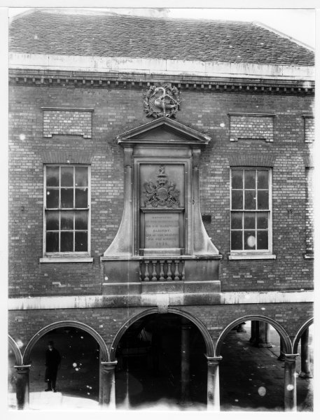
RHW32036 View looking SW from N of the Little market House, showing Market House and Guildhall. Church Sq, High Wycombe. about Aug 1930 Civic building, Streetscape Church Square Sweetland, Market house, with old pump, Guildhall behind and Rivett’s shop, Venn print, presumed Sweetland from neg.no. (HDC) 1930 32036
-
RHW33029
RHW33029 A view from the junction with Kingsmead Rd of the approaches to Loudwater Village, near High Wycombe. Sept 1922 Streetscape Loudwater Sweetland, Loudwater Village, High Wycombe near the junction with Kingsmead Rd The road curves into the village towards the junction with the A40 London Rd A signpost indicates the directions towards High Wycombe and the houses in the main part of the village are in the background. 1922 33029
-

RHW33030
RHW33030 View looking East at Rye Mill, London Rd, High Wycombe. June 1927 Streetscape London Road Sweetland, London Rd at Rye Mill. The River Wye is on the right with the footbridge to The Rye crossing it. Factories with a large chimney are in the background and a line of Telegraph Poles bring Trunk Circuits into High Wycombe. The road is empty except for a parked car in the distance . [b] some damage to rear of print which may be old adhesive. 1927 33030
-
RHW32027
RHW32027 The Black Boy PH at the end of Noyes Lane (all now demolished), in a view of Church St, High Wycombe. about June 1928 Commercial building, Streetscape Church Street Sweetland, With this picture in 2005 the location is the Octagon Covered Shopping area Church Street looking north from Paul’s Row through Church St on to Priory Road The Black Boy pub to the right the old Chequers inn before later demolition then in the distance you see the Railway embankment 1928 32027
-

RHW32028
RHW32028 View from All Saints Churchyard, looking West along the N side of the row of cottages in Noyes Lane, between Church Sq and Church St, High Wycombe. May 1930 Domestic building, Streetscape Church Square Sweetland, the back of the building on the extreme left was King’s Drapery Stores, now (2005) Costa Coffee Shop. The wood framed building is the Watch House. Left of the telegraph pole is the distinctive crooked chimney of the Black Boy PH. This corner of the church yard looks different today. Though the Tudor buildings were demolished before 1939 the Watch House remained in use until the 1950s by the Home Guard and the ARP Scan [a] [c] and [d] are contact prints, [d] is cropped. 1930 32028
-

RHW33025
RHW33025 Looking west towards town from The Rye, a view of a temporary railway on the river bank, and houses on the N side of London Rd, High Wycombe. mid 1930 Streetscape London Road Sweetland, London Rd High Wycombe from The Rye looking west towards the town. A lorry with a sheeted load heads east towards London. A temporary narrow gauge railway line has been laid near the river bank on The Rye side and some construction work is taking place in the distance. 1930 33025
-

RHW33026
RHW33026 River Wye in foreground of a view looking West towards the town along London Road, High Wycombe. April 1929 Streetscape London Road Sweetland, The River Wye and London Rd High Wycombe. The river is prominent in the foreground with large houses opposite. A line of Telegraph Poles are on the opposite bank. 1929 33026
-

RHW33018
RHW33018 A busy street scene with crowds of shoppers and vehicles. View looking West along Oxford St, High Wycombe. 1920s Streetscape Frogmoor, Bull Lane, Oxford Street Sweetland, Oxford St High Wycombe looking west. A busy street scene with crowds of shoppers on the pavements. Two horse drawn carts, an open topped bus and a bicycle are prominent on the road. 1920 33018 Gardner, (Wine and Spirit Merchant), Currys, (Cycle Dealer)
-
RHW14058
RHW14058 The gardens on corner of High St and Queen Victoria Rd, High Wycombe. 1924 Exterior, Landscape, Streetscape Queen Victoria Road Sweetland, the gardens on corner of High St and Queen Victoria Rd 1924 14058
-
RHW14059
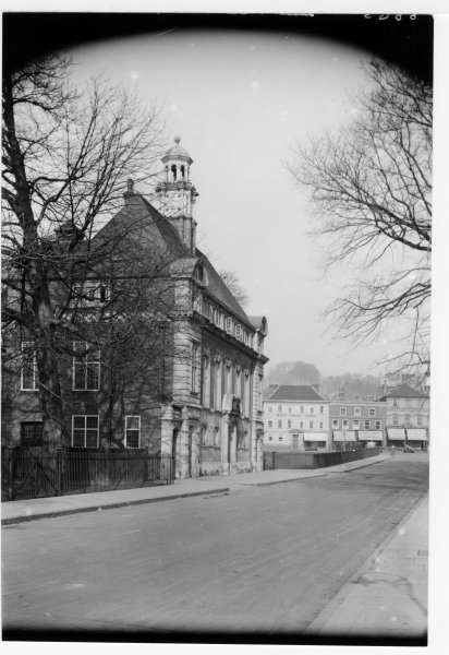
RHW14059 The Town Hall in Queen Victoria Rd, High Wycombe. Feb 1928 Civic building, Exterior, Streetscape Queen Victoria Road Sweetland, Town Hall 1928 14059
-
RHW10016
RHW10016 View of the N facade of the Guildhall, High St, High Wycombe. early 1926 Civic building High Street area Sweetland, N facade of the Guildhall High Wycombe White spots especially on lower half and blurring on lower edge and R side 1926 10016
-

RHW03038
RHW03038 Demolition at junction of Crendon Street/Castle Street, looking N from E side of Crendon Street, High Wycombe. Dec 1930 Commercial building, Streetscape RHW Castle Street, Crendon Street Sweetland, The Flint Cottage The White Lion Clear print, but over-exposed on RH side 1930 03038 Ludlow, (Hairdresser), Smith, H., (Wireless Dealer)
-
RHW14050
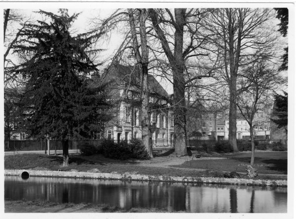
RHW14050 A tranquil scene looking NW over the river Wye towards the Town Hall in Queen Victoria Rd, High Wycombe. Feb 1928 Civic building, Exterior Queen Victoria Road Sweetland, The exterior of the Town Hall RHW14050a 1928 14050
-
RHW90001
RHW90001 Door of the Friends Meeting House, on the West side of Crendon Street, High Wycombe. October 1922 Civic building Crendon Street Sweetland, Friends Meeting House, located on west side of Crendon Street [a] is better copy 1922 90001
-

RHW03036
RHW03036 Street scene of demolished buildings in Crendon Street looking south from junction with Castle Street, December 1930 Commercial building, Streetscape RHW Crendon Street Sweetland, The White Lion Extensive clearance of buildings at the north east end of Crendon Street Appears to be poor copy of slightly damaged original 1930 03036
-

RHW14031
RHW14031 The Town Hall, Christchurch School, and the brewery in Queen Victoria Rd, High Wycombe. July 1928 Civic building, Streetscape Queen Victoria Road Sweetland, viewed from the upper window of the White House, High St 1928 14031
-

RHW14033
RHW14033 Rolls of newsprint awaiting delivery, outside Library Gardens, junction of High St/Queen Victoria Rd, High Wycombe. June 1928 Exterior, Streetscape RHW Queen Victoria Road Sweetland, crossroad High St with Queen Vic Rd, horse/cart with rolls of paper waiting to be delivered. See RPS53237 for more detail. 1928 14033
-

RHW24030
RHW24030 Downley turning viewed from the junction with West Wycombe Rd. Nr.High Wycombe. April 1927 Landscape, Streetscape Downley Sweetland, [a] for digitising 1927 24030
-

RHW01025
RHW01025 Looking South, a wintry scene in Queen Victoria Rd, High Wycombe. Jan 1927 Civic building, Streetscape RHW Queen Victoria Road Sweetland, Town Hall and Christchurch Sunday School under a blanket of snow [d] dimensions 289x200mm, mounted on card 1927 01025
-
RHW26040
RHW26040 Fire at Barratts, Newland, High Wycombe. 24th January 1921. Fire/fire brigade Newland Sweetland, Fire at Barratts, Newland, High Wycombe. [a] recommended for digitising 1931 26040
-
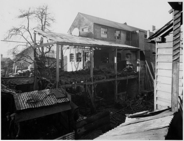
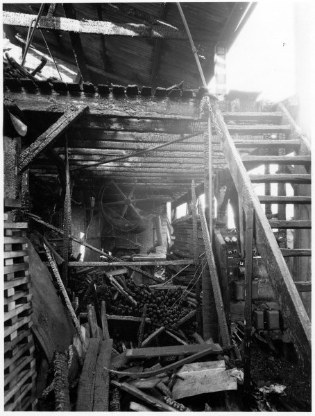
RHW26041
RHW26041 Fire at Barratts, Newland, High Wycombe. 24 May 1931. Fire/fire brigade Newland Sweetland, Fire at Barratts, Newland, High Wycombe. either recommended for digitising 1931 26041